Leisure Wheels 4×4 Safaris is constantly on the lookout for new and interesting safari routes and offerings for the readers. ANDRE VAN VUUREN, our Wild Coast specialist, recently explored the stretch of the Wild Coast between Mazeppa Bay and Morgan Bay and this is what he has to share.
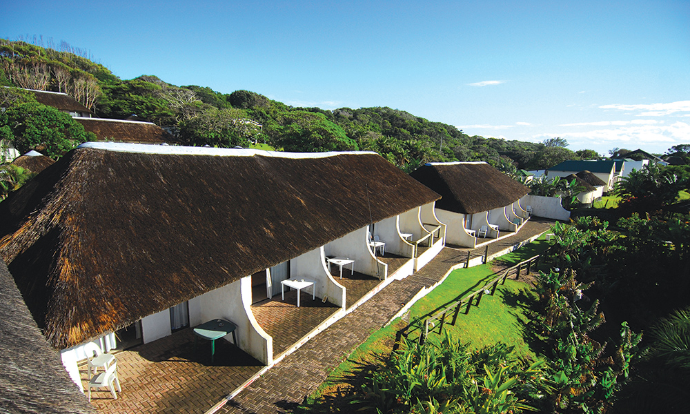
Having done photographic 4×4 safaris and hikes between Msikaba in the northern part of the Wild Coast and Dwesa Game Reserve, we decided to go and explore the southern part of the adventurous and ruggedly beautiful Wild Coast, where one can follow in the footsteps of the shipwreck survivors. Our adventure started at the Mazeppa Bay Hotel, which was taken over by its current owners in 1995. The hotel itself was in a state of disrepair and much love and hard work was put into the place to make it what it is today.
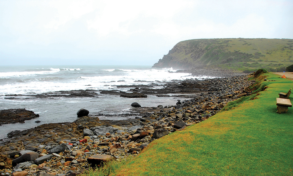
Mazeppa Bay derives its name from the ship, the Mazeppa. The ship was captained by a CJ Cato, on its way to Delagoa Bay (now Maputo) from Port Natal in 1842. The Mazeppa was in search of a British man-of-war, a powerful warship, to rescue the Garrison, which had been besieged by the Boers. The captain steered the ship into what is now known as Mazeppa Bay for shelter and ran aground. Legend has it that its ruins are still buried under the sand dunes there. Mazeppa Bay is one of the most beautiful parts of the Wild Coast and is particularly famous for its fishing. There’s a large variety of game fish to be caught at Mazeppa and the biggest ever caught was a 791kg great white shark.
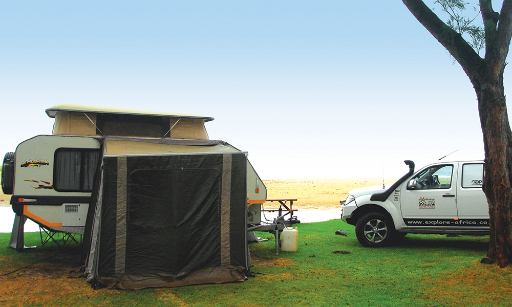
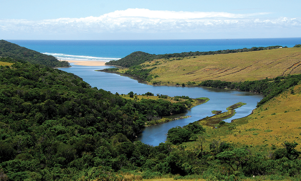
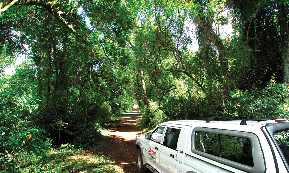
The Bay is characterised by its own island. Depending on the tide, this is sometimes accessible only by a quaint suspension bridge, which joins the island to the main beach. After a night of great rest, we started our journey to Morgan Bay by driving through the beautiful Manubi Forest with its distinctive yellowwood and sneezewood trees. The Wild Coast has many rivers and deep ravines with few bridges near the ocean so one has to drive in and out to get to points along the coast, so what may be a few kilometres walk along the beach from one spot to another entails fairly long drives over very rough roads… all part of the fun.
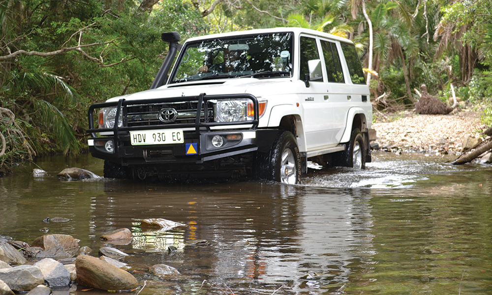
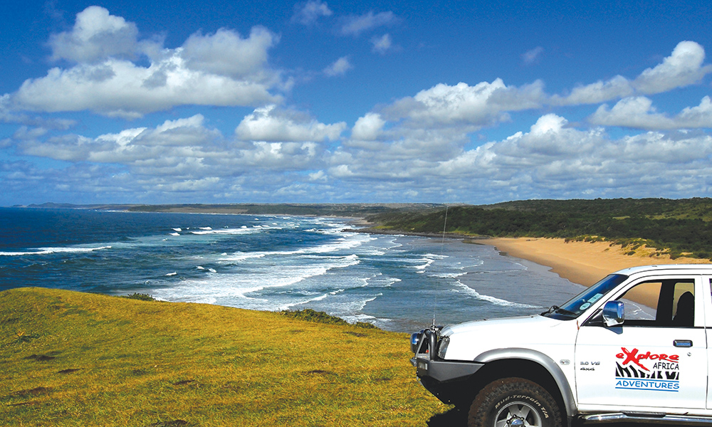
There are numerous beautiful river mouths and we completed some challenging river crossings through rivers by the names of Ngqwara, Gqunqe, Cebe, Qolora, Ngogwane and the Gxara. Areas like this allow only permit holders and residents to enter. Permits are issued by Eastern Cape Tourism in East London and have to be arranged beforehand. An area one kilometre from the beach is considered protected and no new developments are allowed, hence an even wilder look to the Wild Coast than its topography.
Although the 4×4 trekking was part of the tour and fun, the main attraction was the scenery, with hills, rivers, bush and farmlands in every direction. These rural areas of the Transkei Wild Coast have very poor infrastructure so what passes as roads between villages are really just Jeep tracks which are extremely slippery and muddy after rain. The vast majority of land is uncultivated, unirrigated, and, for the most part, unfenced. Our route took us past Wavecrest and the Wavecrest Beach Hotel, which is situated on a pristine, mangrove-lined estuary, surrounded by magnificent dune forests and endless expanses of beach. The next point of interest on our journey was a visit to the Jacaranda shipwreck.
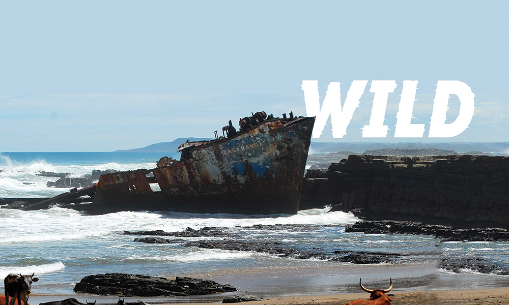
The road down to the wreck was confusing (even with our GPS), with multiple sandy tracks in several directions. Finally our efforts paid off as we arrived at the little beach near the Qolora River mouth where the Jacaranda wreck lies in rusty bits and pieces up against the rocks. During a sunny day, on 18 September 1971, the Jacaranda, a 2 000 ton, Greek-owned coaster, tragically ran aground due to strong winds. The ship’s crew, 15 of them including the captain’s wife, all survived the incident.
According to Captain Kokkios, the skipper of the ship, the Jacaranda was not carrying cargo on the night she ran aground, which is thought to be the reason for her riding high on the water. The ship then suffered engine trouble and was caught by strong winds. Although the crew dropped two anchors in an effort to stabilise the ship, these refused to stay down, and dragged along the sandy ocean floor, causing the ship to head for the rocks.
Now, 42 years later, the sea has rendered this vessel a mere resemblance of a seafaring ship. Ironically the name and its surrounding paintwork seem to have held out against all odds. Cows on the Wild Coast beaches are a common sighting. Whereas the cows may be enjoying the green grass on the beach and fresh rainwater in the rock pools, the real reason for them to come down to the ocean is to find natural salt licks as the herders do not put out salt licks for their animals.
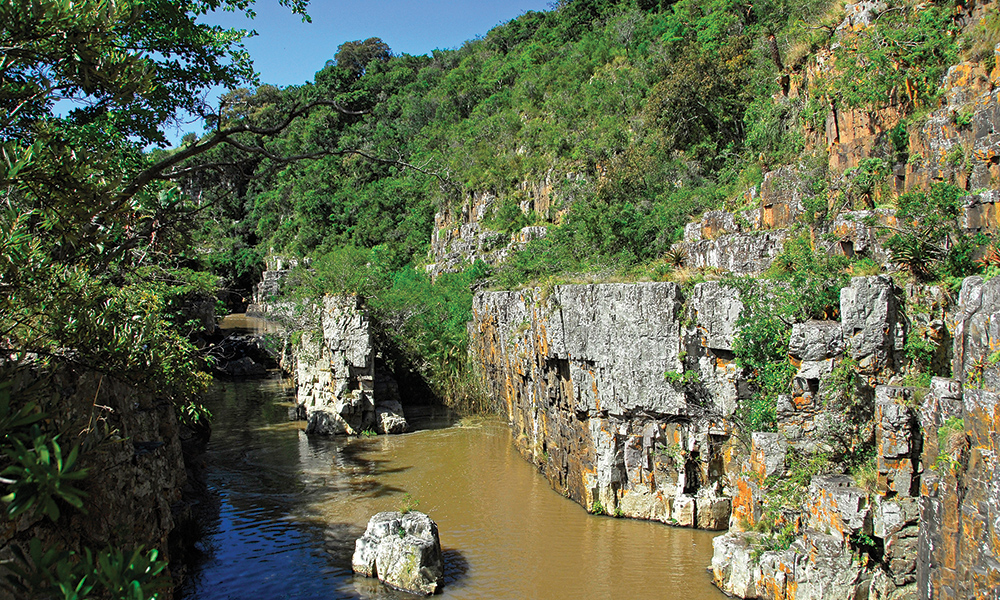
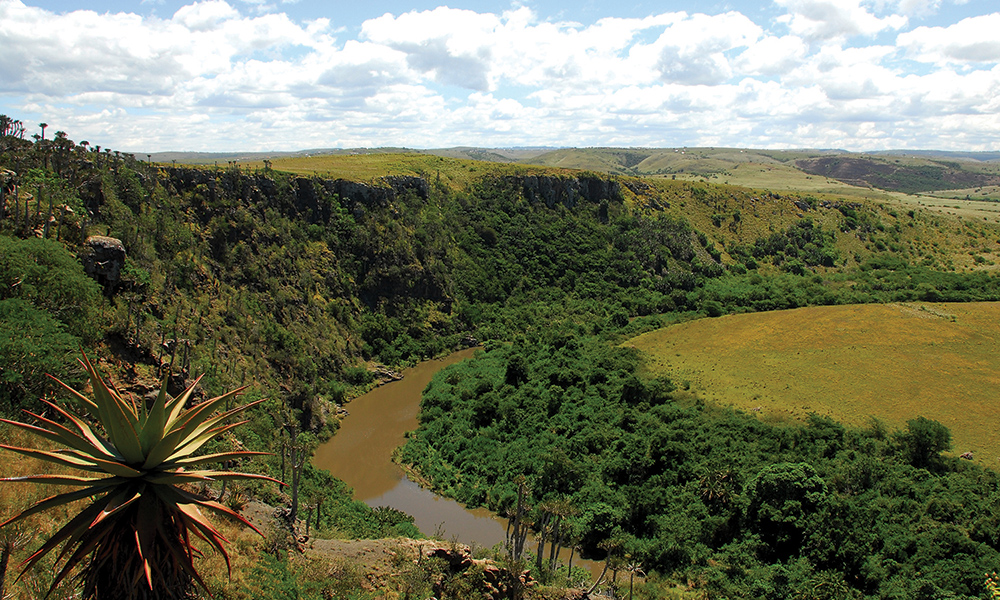
Quite close to the end of our trail we came upon the very interesting and historical Nongqawuse pool in the Gxarha River. The year 1856 was a bad one for the Xhosa nation of the Wild Coast. Their lands had been taken by the British, drought had withered their crops, and their prized cattle were dwindling under a mysterious disease. The people were facing a hard winter when hope came in the shape of a young girl called Nongqawuse, the niece of a prophet. She claimed that the spirits of the ancestors had spoken to her from a pool in the Gxarha River.
If the people would only kill all their cattle and burn their crops, a day would come when new cattle and crops would arise along with an army of the ancestors who would drive the whites into the sea. The “vision” took hold among the desperate people, who followed her orders. By February 1957, more than 200 000 cattle had been slaughtered and left to rot. All the summer crops had been burnt. The allotted day dawned and nothing happened. The weakened population began to starve and within a few months, more than a third of the entire Xhosa people had died of starvation and disease. It was easy for the British to take over the remnants of the tattered Xhosa kingdom and imprison the chiefs. Nongqawuse was taken to Robben Island for her own safety but her people were broken.
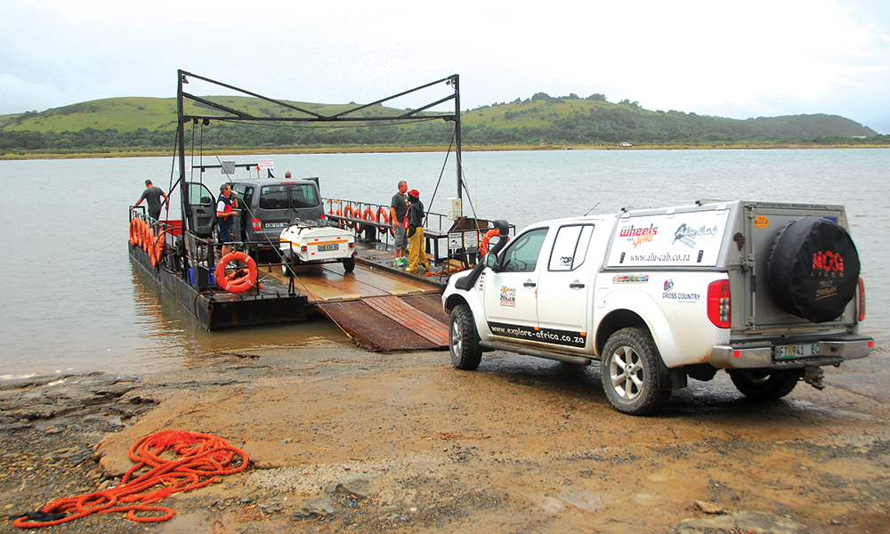
After a long, exhausting but interesting day, we reached the Kei River. The Kei Mouth pontoon is one of South Africa’s two remaining car-transporting pontoon river ferry services, providing visitors with an unforgettable experience 365 days a year, closing only when the river is in flood or the sea too large. The skipper has been operating the pontoon for many years and seemed quite happy in his work. There are bridges further inland, but this saves one from a longer drive, and, of course, it’s all part of the adventure. It costs R100 for a car plus a trailer.
Our route ended in the peaceful seaside holiday village of Morgan Bay, which is located less than an hour from East London. We set up camp on the Inchara Lagoon’s edge under shady trees with the beautiful beaches just a short walk away. All sites have electricity, picnic benches and braai facilities, and are in close proximity to the separate ladies and men’s ablutions. Coin-operated washing machines and tumble dryers are also available. Morgan’s Bay is definitely a destination where one can spend more than a few days.
During the day you can gaze at passing ships on the horizon, relax on the beach with a book, play a round of golf at Kei Mouth Country Club, or take a walk along the beach and picturesque cliffs. There are several good fishing spots in the area and ski-boats can be launched from the mouth of the nearby Kei River. The more adventurous may enjoy a canter along Morgan’s Bay beach with Mkulu Kei Horse Trails, or a game drive at Endalweni Private Game Reserve, while those in need of some pampering can enjoy spa treatments at the Morgan Bay Hotel.
Slightly further afield and only a short drive over the cliffs from Morgan Bay, takes you to the Double Mouth Nature Reserve and the ever-popular Bead Beach (Treasure Beach), site of a 16th century Portuguese shipwreck, where Carnelian beads, money cowries and shards of broken Ming porcelain lie scattered among the shells.