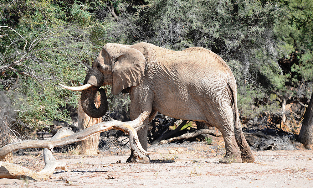
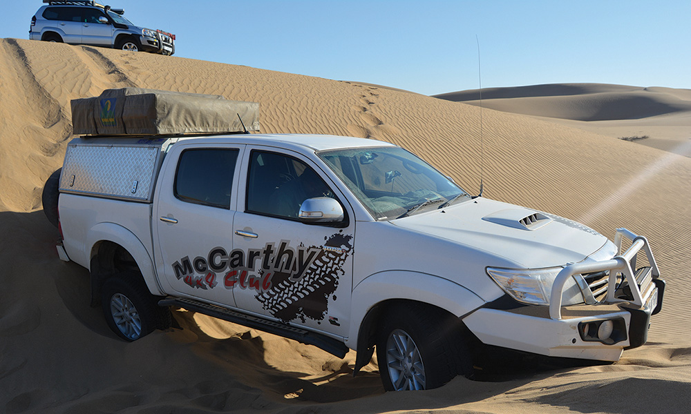
Damaraland in Namibia is one of the destinations on the Bidvest McCarthy 4×4 Club’s annual itinerary and earlier this year, a group of 4x4s headed north across the South African border. Their mission was to explore famous Namibian attractions such as Spitzkoppe and Brandberg. Most importantly though, the group went in search of the elusive desert elephants.
Damaraland
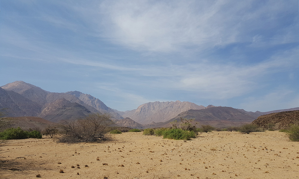
Wedged between Kaokoland in the north and the road between coastal Swakopmund and Windhoek, in the south, Damaraland is rugged and mostly remote. The name hails from the Damara people who lived here before being relocated by the South African government when Namibia was still called South West Africa. Although the region is now officially called the Erongo Region, most people, both visitors and locals, refer to it as Damaraland. It is one of the most scenic regions in Namibia – it’s a massive, untamed, ruggedly beautiful area that offers the traveller a more adventurous challenge.
Here there are prehistoric water courses with open plains and grassland, massive granite koppies and deep gorges. Towards the west, the geography changes dramatically with endless sandy wastes that, incredibly, are able to sustain small, but wide-ranging populations of desert-adapted elephant, black rhino, giraffe, ostrich and springbok. These animals have adapted their lifestyles to survive the harshness of the sun-blistered, almost waterless desert spaces. Elephant inhabited this sparse region and can travel up to 70km in a day in search of food and water and unusually, do not destroy trees in their quest for food.
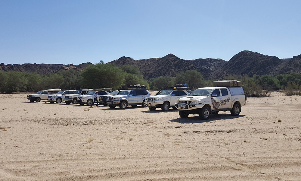
After months of planning and a pre-tour recce in February, an itinerary was compiled and as is the norm, changed, just days before the tour started due to pre-booking issues. Never mind. Still on our menu were: Brandberg, the highest mountain in Namibia and home to the famous ‘White Lady’ Bushman painting; Twyfelfontein, with thousands of Bushman paintings; Spitzkoppe, the famous, massive monolith rock; the historic Petrified Forest that is millions of years old; and, most importantly for many of us, the desert elephants. On a cold June morning we started off in Pretoria with four vehicles. In Rustenburg, on our way north, we were joined by three more. The last two vehicles would later join us
in Kang in Botswana and Gobabis in Namibia. As we were doing the necessary cross-border procedures, we ran into our first surprise. I prefer the term ‘surprises’ instead of ‘problems’ – trips like these always have a way of dishing up a few despite the best preparation and planning.
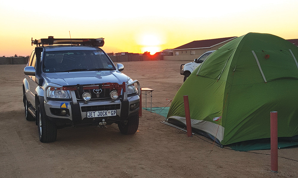
In the rush to be in time for our departure, tour member Malinda had grabbed her and her husband Chris’ passports from the safe, jumped in their 4×4 and off they went. Standing in front of the border official presenting their passports, they were surprised to see that Malinda has brought her expired passport along. This meant our convoy of seven vehicles was suddenly reduced to six crossing the border, while Chris and Malinda turned back to fetch the valid passport. That evening we met up with Des and Sanet at Kalahari Rest Lodge, near Kang in Botswana. After a good night’s rest we were busy breaking camp when Chris and Malinda popped out of one the chalets – they had arrived around midnight. Our next overnight stop was at Ombonde Open Sky Camp at Okahandja, just west of Windhoek. En route we were joined by Tinus and Martie at Gobabis and for the first time, our convoy was complete.
We pitched camp at Ombonde that afternoon. Ombonde is a pleasant, rustic camp about 5km outside Okahandja, owned by Andre van Dyk. We told Andre we planned to make our way to Twyfelfontein via Otjiwarongo, Outjo and Khorixas. Andre suggested we rather take the dirt road to Brandberg via Omaruru and Uis. From Brandberg we could then take the tweespoor track direct north to Twyfelfontein. This way we get to the lesser-travelled roads faster – and that is, after all, why we have 4×4 vehicles. This section from Brand-berg to Twyfelfontein took us through typical Kalahari dune veld. The magic of Damaraland was clear: live paintings of yellow and rusty brown with a dash of blue sky. Beautifully rugged.
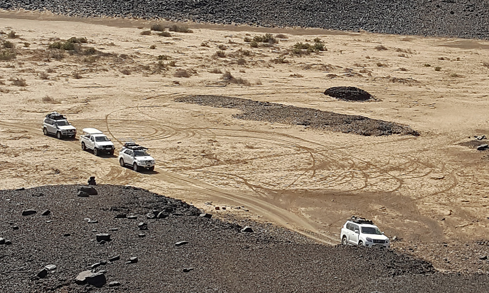
Late that afternoon, we passed the Burned Mountain and the so-called Organ Pipes tourist attraction. To me the Burned Mountain looked more like a heap of coal and the Organ Pipes like a heap of cylindrical rocks stacked together in a riverbed. Maybe too much of a hoo-ha, as a result of tourism attractions blown out of proportion, for the purpose of attracting overseas tourists? Definitely not worth the money if there was a charge to see them. That afternoon we pitched camp at Mowani Mountain Camp. Mowani Mountain Camp is nestled between massive granite rocks towering above the campsites with a shower and running water toilets purposely built between the rocks to blend in with nature and its surroundings. This would be our base camp for the following three nights. On one of our outdrives, we travelled along the Aba-Huab River on a 4×4 trail towards the Petrified Forest. And then the magic happened: we got our first sighting of the famous desert elephants of Namibia. After visiting the Petrified Forest accompanied by one of the guides sharing his knowledge with us, we returned to camp.
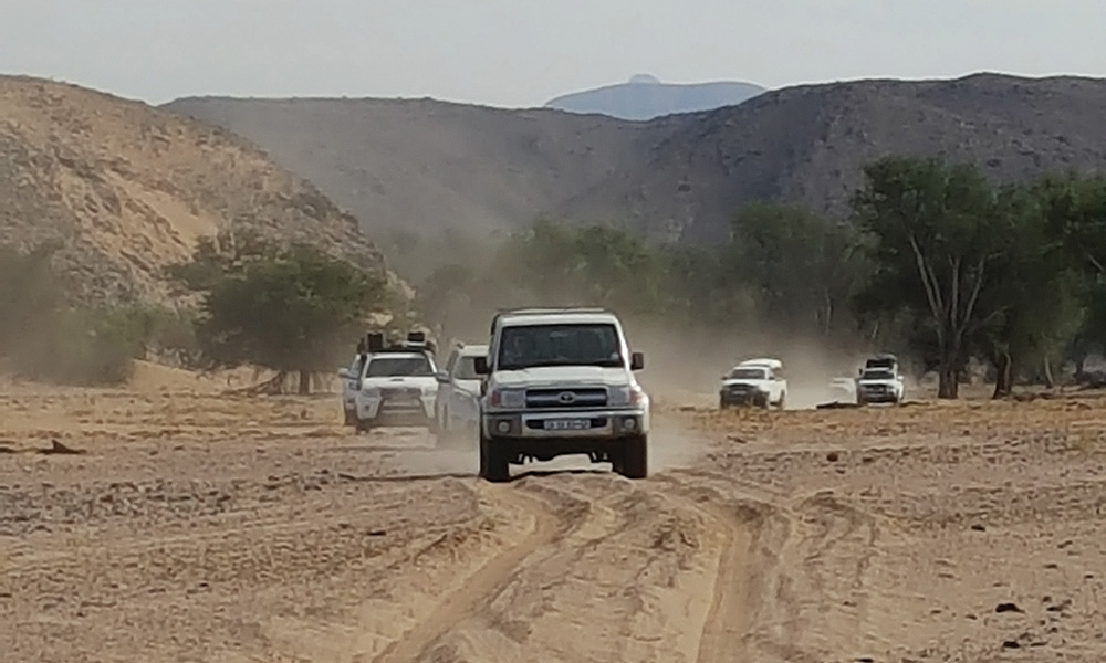
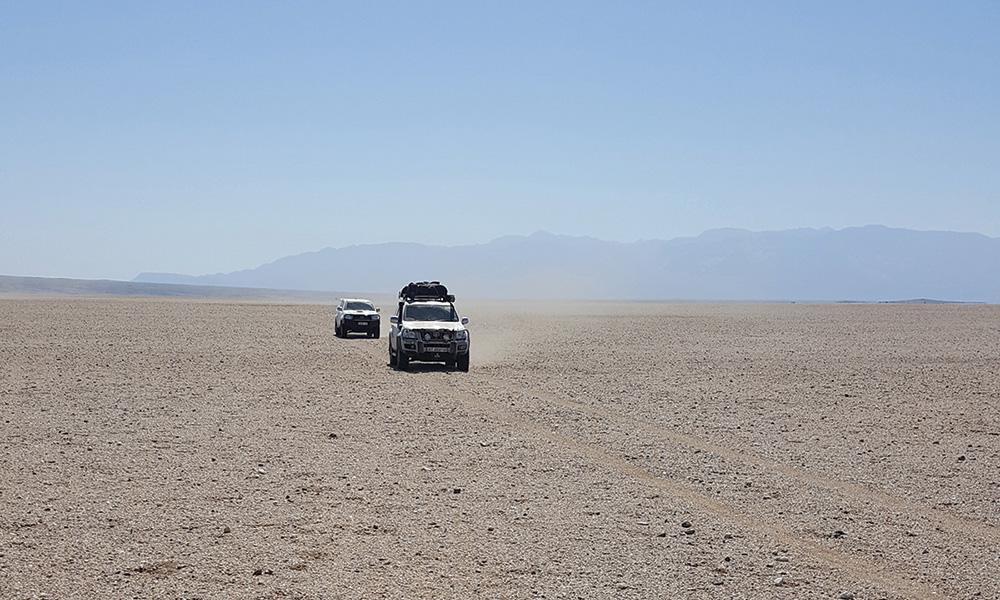
The next day we travelled from Twyfelfontein, avoiding the main road along tweespoor tracks via some fantastic landscapes of Kalahari sandveld, desert sand flats and rocky outcrops to where the Aba-Huab River joined another river. We were about two kilometres from the point where the two rivers joined when we came across a lonely desert elephant bull, lazily grazing away and rubbing himself against the trees. We continued north-easterly in the Upper Huab River trail and surprise-surprise: the river had flowing water. After a few river crossings, we reached a date farm halfway up the trail. From there we took a dirt road to Khorixas to refuel empty fuel tanks and stock up on groceries. As the sun rose on 2 July, we continued our adventure along the Huab River in a south-westerly direction in search of more desert elephant.
We came across giraffe, oryx, steenbok, baboon, springbok, ostrich and Hartmans mountain zebra along the dry riverbed. I have not mentioned the different species of bird yet because there were so many, including a few we’d never seen before. And then, making a star entrance as we ambled around a corner, a herd of desert elephant, peacefully grazing away. A mother even came out of the bush, seemingly proudly showing off her calf to us. As we progressed, the dry riverbed became wetland swamp and we had to leave the riverbed to continue with the trail through some spectacular rock formations and rocky hills. You may think a rock is just a rock is just a rock – but then you haven’t been to this place. Around every corner nature provides you with some spectacular formations and different panoramas.
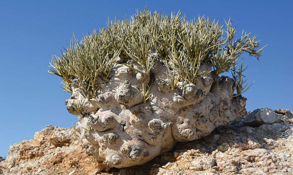
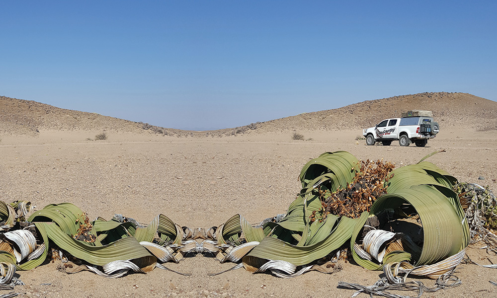
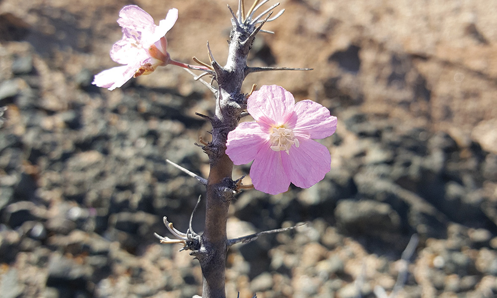
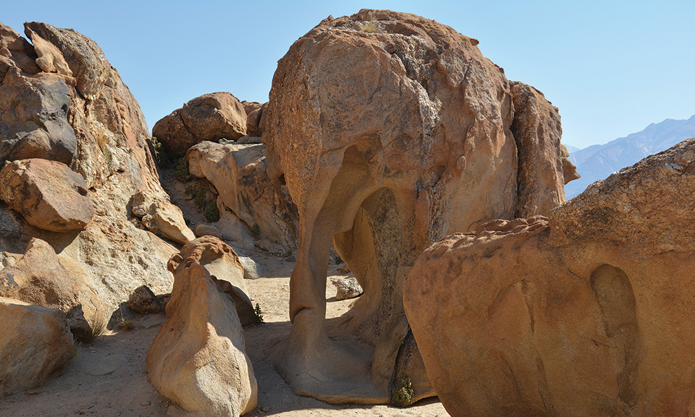
As someone commented over the radio: “You try and try to capture the beauty on camera, to show everybody at home but it’s just not possible.” The tracks took us through an arid stone desert called Desolation Valley to the Gai-Ais Fountain. And just as we reached this waypoint, a herd of Hartmans zebra fled over the rocky terrain at great speed… how these animals manage to run at such pace over the extremely rocky terrain left us in awe. Hiding from the westerly winds, we pitched camp at Klein Gai-Ais at the base of some stunning rock formations, which seemed to guard our group that night. The next morning, after a sumptuous breakfast, we continued on our travels. We stopped at another petrified forest, which we reckoned was probably more spectacular than the more touristry Petrified Forest we had visited between Twyfelfontein and Khorixas. Later, Mother Nature dished up a splendid sight: a garden of welvitchias. Most of these plants are older than a thousand years. Another amazing moment.
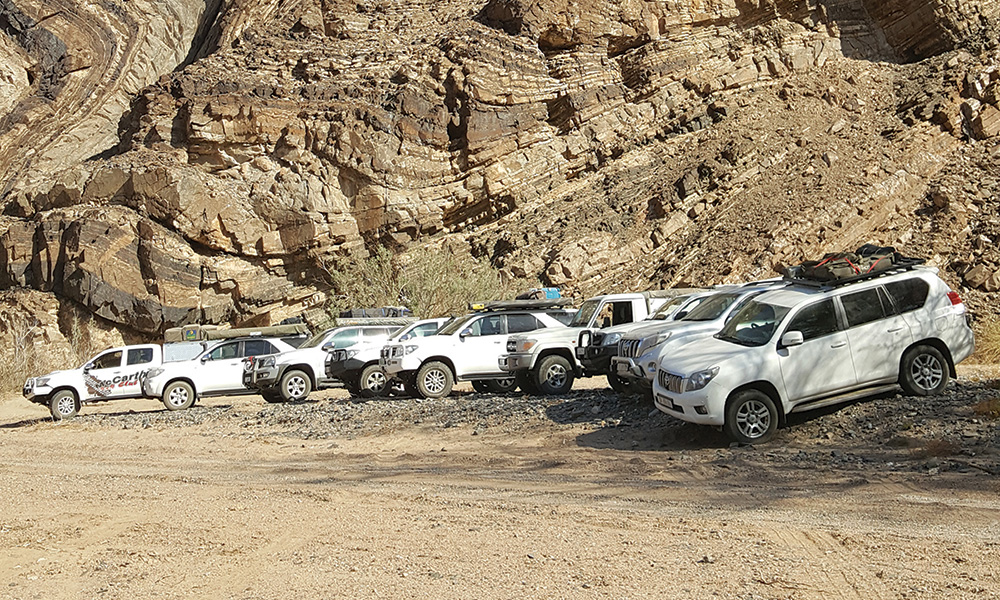
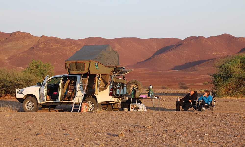
At this point we broke the rule again and instead of continuing straight at a crossing of trails, we turned right. Ignoring our itinerary, this meant that instead of driving around the Doros Crater we stuck to the western side of it. Not planning to trade the comfort of our vehicles for a pair of takkies or walking boots just to enter a mountain of rocks, we rather followed the garden of welvitchias. This track led us through some spectacular canyons to the Ugab River at the Rhino Camp. Also on our bucket list was to drive the infamous Divorce Pass – so-called because of its rocky, bouncy nature that often leave wives and girlfriends rather shaken and ready to negotiate divorce procedures. So we turned into the Ugab and headed to the pass. During lunch break in the shadow of some spectacular Ugab cliffs, we made a call: we wouldn’t overnight at Rhino Camp but rather do another wild camp in the Ugab River Valley. We traversed up the pass for about 10km and then returned to the Ugab River where we pitched camp for the night.
The next day we headed for Brandberg West Mine and then took the D2303 in a westerly direction. As we reached the Messum River crossing, we continued along the riverbed east towards the Messum Crater, an inactive volcano that is millions of years old. En route we passed the Messum River Terraces and some giant welvitchias. What a sight! We crossed the Messum Crater and headed towards Brandberg again. As nightfall arrived, we were between the Messum Crater and Brandberg, driving along the Messum River. We set up another wild camp to be fresh for the following day. As we continued our journey east towards Brandberg, the landscape changed dramatically yet again. We linked on to the Brandberg 4×4 trail that encircles the mountain. Another day, another display of God’s stunning creation.
We remarked that this was exactly the reason we drive 4×4 vehicles. Not to drive the biggest hunk of metal in town that can park on a pavement, but to reach places like this. Places that not everyone can reach, that we are extremely privileged to experience. The next day we continued towards the White Lady Lodge in the Ugab River – and the desert elephants made yet another appearance. To think that, before this trip, we had pondered if we would see just one – we were indeed lucky to have seen so many. We pitched camp at the White Lady Lodge, our base for the following two nights. We visited the White Lady rock painting the next day – only to be informed that it is actually not a white lady at all, but an impression of a traditional ‘medicine man’.
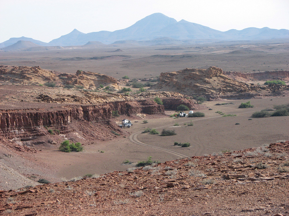
We continued to explore in our vehicles, driving along the Brandberg 4×4 route on the eastern side of this majestic mountain to complete the route directly north of the rocky outcrops and to link on to the Mineral 4×4 route. We stopped at the Elephant Rock where the next 4×4 route starts. The Minerals 4×4 route took us through an arid desert littered by mines no longer in operation. We were supposed to link on to the C34 between Cape Cross and Henties Bay, but the track spewed us out just south of the Messum Crater and so we linked up to the C34 at Cape Cross. We visited the Cape Cross seal colony and then continued our journey to Henties Bay.
We made our base camp for the next four nights at Henties, expecting misty wet conditions. But Mother Nature had some surprises in store: the infamous ooswind, or east wind, made the days rather unpleasant. It was really like living in a dust storm for a few days. Over these days, everyone explored the area as they wanted, some taking in the sights and sounds of Swakopmund and Walvis Bay. We obtained permits to drive some dunes between Dune 7 and Langstrand – it would be our last adventure together before heading home. On the day of our dune driving experience, that ooswind was at it again, whipping up the Namib sand in a rather unpleasant manner. Hoping the wind would subside, we headed to Pelican Point – and wondered why it wasn’t called Seal Point… there were thousands of seals but very few pelicans.
By midday we finally aimed for the dunes, and playtime. The wind had thankfully taken a break, but during the morning it had churned up the dunes to such a degree that it was quite a challenge navigating through the dunes… what looked like a slip-face was not always a slip-face up close, and what looked like an inconsequential little heap turned out to be really tricky. But we certainly had fun. At 5pm that afternoon, perched on top of a dune, we watched the sun set over the Atlantic Ocean. Shortly afterwards we headed north, the two-way buzzing as the guys shared their sand driving experiences. That 100km drive flew by like it was just around the corner, listening and laughing at all the stories. The next morning the great trek home began as we struck our camp in a storm of dust. We headed towards the Omaruru River from where we continued our journey along the riverbed. We passed Omdel Dam, a water reservoir desperately in need of water. It was bone dry.
We had lunch at Shoe Rock, and our last 4×4 ride on the Omaruru 4×4 trail. That night we pitched camp at the famous and beautiful Spitzkoppe camp, with the sun providing us with a fittingly spectacular lighting show as its rays played across the rocky outcrops. So came our adventure to an end. En route back to Gauteng, we overnighted at Xain-Quaz, Gobabis and at the Kalahari Sands Rest Camp in Botswana. And finally, we arrived back in the big concrete jungle.
It was a great adventure. As the saying goes: life’s a journey. Enjoy the ride.
Text and photos: Tinus Breitenbach