Text and photographs: Neville Lance
We took the first major dirt road turning north off the R382 between Steinkopf and Port Nolloth towards Eksteenfontein. The Richtersveld actually begins when you leave the tar and stretches from the N7 in the east to the coast in the west, and from the R382 in the south to the Orange River in the north.
Eksteenfontein is one of four villages that can be found in this area and is inhabited mainly by BOSLUIS-BASTERS – descendents of European families who settled in the area in the early part of the 20th century and who were deposited in Eksteenfontein and Lekkersing after being evicted from Crown lands in Bushmanland.
From there the drive north winds through some really beautiful countryside, until the village of Kuboes can be spotted set right at the feet of the mountains that make up the south-western border of the Ai-Ais/Richtersveld Transfrontier Park.
Kuboes is the oldest village of all the communities in the Richtersveld, and the most attractive. The ancient Nama culture still prevails here. The missionary centre in the town is reminiscent of something out of an old Mexican western movie, with only Marlon Brando, Anthony Quinn, some horses and a few senoritas needed to complete the illusion.
From Kuboes one has to retrace one’s steps a few kilometres in order to get back on track to the next stop of any consequence, which is the main entrance to the park at Sendelingsdrift.
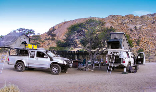
Here we camped, and the occasion being what it was, dinner consisted of skottel-fried piri-piri tiger prawns in loads of lemon butter and garlic, Basmati rice, and a very well chilled bottle of Pongracz. Who says that camping cuisine isn’t up to the same standard found in the more upmarket lodges?
The next morning started with a relaxed breakfast before trundling down to the new pont across the Orange River, which constitutes the most recent South African/Namibian border crossing. The pont is a welcome replacement for the old one that was last in service in 1988 and was wrecked in floods just prior to Namibia’s independence. With the re-opening of this border post all sorts of new travel opportunities become available – such as being able to do a quick hop, skip and jump up to Sossusvlei as part of a combined trip to the Richtersveld. Before this would have required a 1000km detour.
Travelling through the NamibRand, which is Southern Africa’s largest privately owned conservancy, we were lucky enough to see small herds of springbok, gemsbok, zebra and ostrich – all in magnificent condition – all set off by endless expanses of grass.
To reach Sossusvlei you have to go through Sesriem, a Namibian Parks establishment offering accommodation and camping at rates that are pretty high for South Africans.
The nearest alternative campsite to Sesriem is 42km away, and the powers that be have decreed that only those camping or staying within their confines are allowed through the gate to Sossusvlei one hour before sunrise. People coming from outside are only permitted entry an hour later, which means that with 65km still to go to the vlei they have absolutely no chance whatsoever of being there for one of life’s “must do” things: watching the continuously changing palette of colours and contours that the dunes present during those first few precious minutes after the sun explodes in the east.
On very rare occasions, during exceptionally rainy seasons, the Tsauchab River might flow as far as Sossusvlei – but once there it is prevented from going any further by a sea of sand that stretches some 60km or so to the coast. Strictly speaking the word Sossusvlei applies only to the hard circular pan where the Tsauchab is finally forced to stop flowing, but in more recent years the entire plain of the Tsauchab River together with the giant red dunes that rise to the south and west of the river plain has become known by this name.
One needs a 4×4 to tackle the last 5km sandy stretch to the vlei itself, before making an exhausting dash up the ridge of what must be the world’s most photographed dune. The overwhelming sense of space, of shapes, of sand, and of colour – all working together in an assault on the senses – is quite stupefying.
Heading back we took a loop along the Eastern edge of the Namib-Naukluft Park with the foothills of the Tirasberg to our left. A worthwhile detour with wonderful landscapes and contrasts.
As one approaches Lüderitz from Aus, a group of very dreary-looking buildings appears on a rise to the left of the road. They are the colour of the surrounding desert and seem merely to “sit” within their sweltering environment, offering no enticement whatsoever to be visited.
Only a small sign on the side of the road – “Kolmanskop” – gives any indication that you are headed in the right direction to visit the legendary “ghost town” spawned by the diamond rush of the early 20th century.
After paying the R42 pp entry fee, we were directed to a parking area in front of a rather drab looking town hall-type building where we stepped out into the searing heat and went to register for the tour, fully expecting to be disappointed.
Were we wrong? Seriously wrong! Our guide was a local fellow with huge enthusiasm for Kolmanskop and its history, and literally within minutes of starting the tour the town began to come alive as he etched images of a bygone era with a dialogue swathed in metaphor and a very real knowledge of his subject.
How Kolmanskop came into existence is extremely well documented and reads much like a Conrad novel – except that it is all for real. In 1908 a railway worker, Zacharias Lewala, found a sparkling stone amidst the sand he was shovelling away from the railway line. His supervisor, August Stauch, tried to convince the company he was working for that the area was diamond rich, but they were so obsessed with their search for other minerals that they never took him seriously.
Stauch quietly went about staking claims everywhere – and when the rush started he became a very wealthy man in a very short time, with Kolmanskop providing 20% of the world’s diamond supply in its first year of operation.
It soon became a bustling centre with all the amenities of a European town: butcher, baker, furniture factory, soda water and lemonade plant, ice factory and a four-skittle alley which is still in perfect condition today.
Then bigger diamond fields were found at Oranjemund and the entire population of Kolmanskop moved their operation further south. Within a span of just 40 years Kolmanskop had been established, lived, flourished and died, and today the ghost town’s crumbling ruins bear little resemblance to the grandeur of its former glory.
After a delightful and informative morning we visited Lüderitz for lunch. What a beautiful little town! I understand that we were fortunate the wind was not blowing, but on the surface of things it appears to be an ideal resort for a short sojourn, offering a wide variety of restaurants and places to stay, as well as a quite magnificently positioned campsite out on the point.
We crossed the Orange again for four days in the Richtersveld and immediately made our way to De Hoop via Akkedis Pass. It gave us a foretaste of the mountains we were to see later, and the road was probably the trickiest of all that we drove while there – but no more than a grade two 4×4 at its worst.
At first glance De Hoop is great, but the ablution blocks only service the first two campsites and moving beyond them requires total self-sufficiency in every respect – which also has its advantages. The river was great, the swimming great – there were plenty of birds and plenty of fish – but when that wind starts blowing you really want to be somewhere else.
We were only too happy to move on out of De Hoop first thing on the third day, making our way along the only section actually “designated” as a 4×4 trail in the park… the river route to Richtersberg.
The Ai-Ais/Richtersveld Transfrontier Park is an awe-inspiring mountain de
sert with a huge diversity of arid plant species and is run as a contractual national park under the management of SANparks, with full participation by the local community.
The park is dominated by two main rivers, the Gariep River that is still known officially as the Orange, and the Fish River that flows through the Ai-Ais Hot Springs Game Park and unites with the Orange.
As we approached the Helskloof Entrance gate the mountains suddenly turned into an absolute garden of succulents and fynbos for a distance of about 10km. There were vygies flowering everywhere – daubs of smiling paint on an otherwise generally dark grey canvas, but up near De Koei in the Helsberg the Hotnotsriem / Wolfstoon provided a display we are unlikely to ever forget.
The Richtersveld is not a place that we’ll hurry back to, as opposed to the other side – the Fish River Canyon – but we are pleased that we went there and had the opportunity to see and contemplate this extremely tough corner of our heritage. This is truly “hard” country.
