Glyn Demmer recently ran a “regularity raid” under the banner of the Four Seasons Adventure Series. Judging from participants’ queries, it seems that few people have a foundation in basic navigation.
The X and Y co-ordinates used in mapping and navigation are known as “Cartesian” — having drawn the name from the French mathematician and philosopher, Rene Descartes. They are used to indicate one’s location or position on a map.
The X axis runs horizontally and the Y axis vertically. Together they form a co-ordinate.
One can always remember that X runs to the left (and right) and Y to the sky (and down). Thus latitude would be the Y axis and longitude the X axis.
Descartes has often been thought of as the founder of modern philosophy, as well as analytical geometry. His mathematical genius in referring to a point as a set of numbers is known as the Cartesian coordinate system.
In SA, the X and Y coordinates are known as Gauss Conform Coordinates or LO coordinates. On a Garmin unit they will be referred to as the SA Grid.
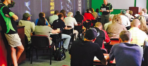
On the day, the teams were split up and navigators were briefed while the drivers stood by their vehicles for scrutinising.
A “regularity raid” is a great event as it combines on-road and off-road skills and is heavily based on navigation. Contestants have to find a series of waypoints, answer questions and complete a tricky off-road section — all within a pre-determined time frame. Arrive too early at a point and you could be penalised for speeding; exceed the cut-off time and you could be disqualified.
To avoid competitors following one another and simply tagging along, routes were alternated and only came together at main waypoints such as the 4×4 trail, where contestants were once again split onto two trails.
This was the fun side of things as there were some nice rivers to cross as well as some tricky obstacles caused by a Highveld morning storm.
The route started at the Navworld facility in Strydom Park, Randburg, where staff were on hand to assist with GPS-related queries and set-ups. Competitors then moved along via Northgate and the Lion Park to Pelindaba, where there were questions relating to various graves at the Preller Cemetery.
Then it was on to the Sappersrus Shrine (the monument to Sappers who had served and fallen in the various conflicts), and the ADA facility for the 4×4 tasks.
On arrival at the final checkpoints, competitors handed in their GPS units and score sheets for evaluation and marking prior to the prizegiving. Thanks to the sponsors (Nissan SA, Cross Country Insurance, Tiger Wheel and Tyre, Navworld and Dixon Batteries) all competitors received a complimentary SecureTech hold-all, filled with a variety of useful items.
Prizes were awarded for the top three competitors, with trophies being handed out for first and second place. The winner on the day was Hannes van Rensburg from Lichtenburg, driving a Nissan Navara.