On our last expedition, Voetspore in the Great Rift Valley, we spent a lot of time below sea level on the African continent. You get “altitude sickness” when you climb a mountain such as Kilimanjaro, but what do you get when you go below sea level? The answer: a Danakil Depression!
Text: Johan Badenhorst
There is a place in Ethiopia called the Danakil Depression, also known as the Afar, and we spent a few weeks there. This is a region in the north-east, spilling over into Eritrea and Djibouti. It is one of the most remote areas in Africa, where the Rift Valley runs into the Red Sea.
Getting to the Danakil is simple in one way yet complicated in another. We were fortunate not only to have proper guide books but also to get advice from a number of tour guides in Addis Ababa. They warned us to prepare properly.
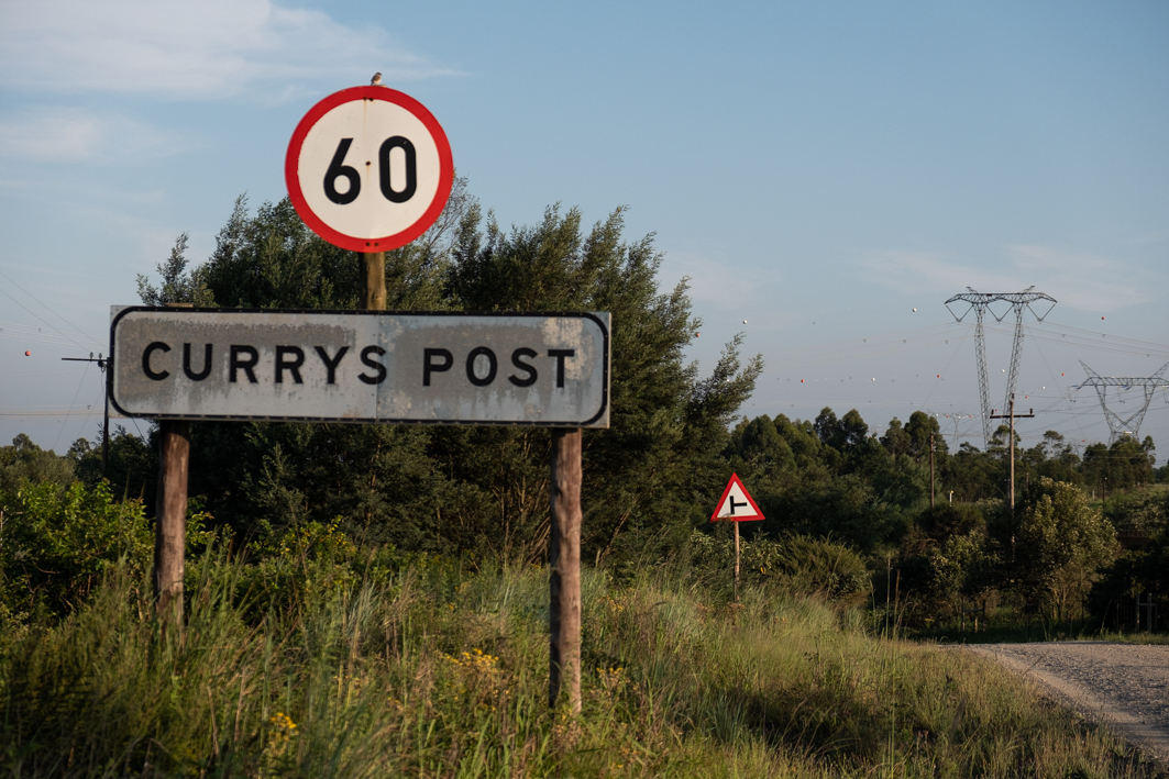
We started off at Samara. This is a newly constructed town in the middle of a semi-desert. A number of apartment buildings and hotels were recently completed.
We had to report to the Afar National Regional State and apply for permits from the Afar Tourism Commission. There was a fee to be paid. More importantly, though, the authorities needed to be aware of any foreigners in the region – for good reason. A few years ago four tourists were caught in an ambush and killed. The nearby border between Ethiopia and Eritrea remains a war zone, after all.
After spending an evening at Samara, eating njera and tibs and drinking St George beer at the Oasis Hotel, we left for the Afar.
At Serdo we turned north, away from the highway that connects Ethiopia to the Red Sea via Djibouti. There was a surprise – it was a brand new tar road. According to our research, the road was supposed to be gravel with a terrible surface. Now we were travelling at 100 km/h instead of 40 km/h! The 200km journey took less than two hours instead of the eight hours we’d been expecting.
We quickly reached the dusty town of Afrera. Here there are massive salt mines, where salt is scraped from the ground after water in the pools has evaporated. The team acquired new attire – a gown that the Afari refer to as a “shirit”. This is what local men wear. It is much cooler than trousers, or even shorts.
We were heading for a place that was said to be the warmest on earth. We had to take every precaution to protect ourselves – from the climate and any insurgents.
I was told in Samara that just before or after Afrera there would be a road block where we would be provided with armed guards. Tourists were apparently not allowed to travel unescorted in this part of the world. But when we got to the road blocks we were just waved through. This was possibly because of the appearance of our vehicles. The Voetspore Amaroks had a little bit of a “camouflage look” about them. Perhaps the soldiers at the road blocks thought we were on “official” duty.
We went deeper and deeper into the Danakil. At one point we dropped below sea level (fortunately no signs of the “depression”). We were consistently driving at a level of 100m below sea level.
The beautiful tar road gave way to a dusty track. We followed the Tracks4Africa route. The dust was extreme. This was what we had expected to encounter all the way. The next 100km took forever to traverse, and late in the afternoon we arrived at Dallol.
This town holds the official record for the highest average temperature for an inhabited location on earth. When we arrived, just before sunset, the temperature was in the high forties. And this in the middle of winter!
There were a few other tourists in Dallol as well. They had arrived in Cruisers and Patrols, accompanied by guides and armed guards. We had to make arrangements to get escorts at the local garrison for the next day’s excursion to the attractions of the region.
The following morning, each Amarok accompanied by two guards, we left for a place simply called The Colourful. This is an astonishing place with hot mineral-enriched water, bubbling up from under the crust of the earth, forming little puddles. The temperature of some of the water fountains was above 60C. It is a weird and wonderful place.
After The Colourful, the next stop was the World of Marvels – a number of pillars, shaped by wind erosion over the centuries. Once more, it was a place like no other on earth.
With the sightseeing done, we headed for the place that made Dallol famous – the salt mines.
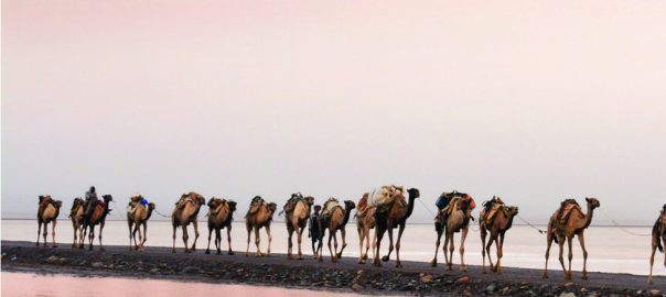
The pans are massive, with the salt taking the form of a crust on the earth. This crust is chopped up with hand axes by the skilful Afari workers into blocks of 4kg each. These blocks are stacked in piles until they are loaded onto camels that are brought to Dallol specifically for this reason. The camels carry the salt over a distance of about 50km, out of the Danakil Depression. From there trucks can take over.
The camel caravans of the Danakil create scenes that previously we had witnessed only in National Geographic documentaries. Now we have been there and seen them ourselves.
But therein lies the problem. A few kilometres to the west of Dallol the new tar road begins. This place, once described as one of the most remote on earth, is now quite accessible. You need the necessary permits, of course, and pay the required fees. Yet you can drive there in your own 4×4. Soon the camel caravans will be something of the past, as trucks will be able to drive all the way to the salt pans to pick up their cargo.
The adventure destinations on the continent truly are becoming scarcer by the year.